Pick your perfect camera angle — then send your DJI drone to take the exact shot
Get the Extension Now →
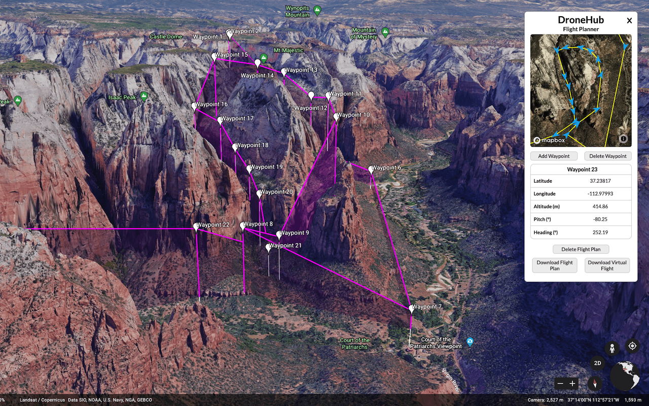
Take the guesswork out of aerial photography and videography with precision planning
Plan your exact shot composition in Google Earth before you even take off. No more trial and error in the field.
Stop wasting battery life searching for the perfect angle. Know exactly where to fly before launching.
Create sophisticated multi-waypoint missions with precise camera angles at every stop.
Plan drone shots from anywhere in the world. Perfect for pre-production and location scouting.
Save and replay your flight plans to capture the same shot at different times or conditions.
Works seamlessly with your DJI drone's flight systems for smooth, automated execution.

From planning to flight in three simple steps
Navigate to your location and find the perfect angle using Google Earth's 3D terrain and buildings.
Click to add waypoints with exact positions, altitudes, and camera orientations for each shot.
Send the flight plan to your DJI drone and watch it execute your vision with precision.
From professional productions to personal passion projects
Pre-visualize complex aerial shots and share flight plans with your entire crew.
Consistently capture stunning property shots from the best angles every time.
Scout epic locations and plan golden hour shots before making the trek.
Document project progress with repeatable flight paths for consistent comparisons.
"This extension has completely changed how I plan drone shoots. I can now scout locations from my desk and show up knowing exactly what shots I'll get. Saves me hours on every project."
"As a real estate photographer, consistency is everything. Being able to replicate the same shots for different properties has been a game-changer for my business."
"The ability to plan complex multi-waypoint missions in Google Earth is incredible. My clients love seeing the pre-visualization before we even start filming."
Join hundreds of drone pilots who are already planning smarter, not harder
Get Started Today →If you'd like to cancel your subscription, you can do so anytime by sending a subscription cancel request to pro@roofmeasureguys.com